 Flooded City
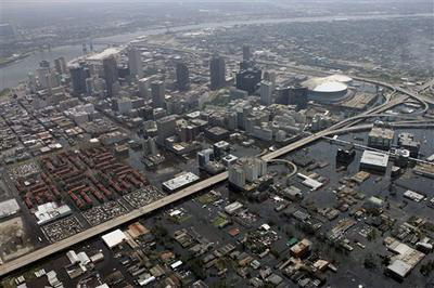
New Orleans, flooded. This is from the Northwest side of the city. I
think this view would be from roughly over the fairgrounds, where Jazz
Fest is held. Interstate 10 is the major road in the center of the
picture. The red buildings on the left are the Treme projects, where
you saw people going back and forth from, looting the Winn-Dixie.