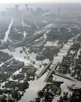
 Flooded City
New Orleans, flooded. This is from the west side of the city, looking
towards the river. Interstate 10 is left center, running towards the
dome. The overpass with the ramp that joins it towards the bottom of
the frame is Palmetto Avenue, where it goes over Airline Drive. As it
goes towards the city it turns into Washington Avenue. Note the smoke
plumes from several fires in the city.