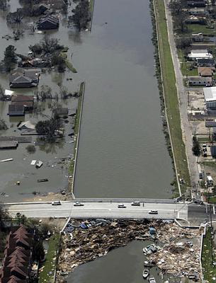
 17th St. Levee Breech
This view looks south from very near the mouth of the canal at Lake
Ponchartrain. Orleans Parish is on the left, Jefferson Parish is on the
right. Compare this picture with the second one
of the breech. Notice that this is after the water level in the city of
New Orleans had equalized with that of Lake Ponchartrain. Also notice
that the area on the right (which is on the left in the other photo),
is now dry. The flooding on the Jefferson Parish side of the canal was
apparently just due to storm surge, and the water there naturally
receeded.